Mining and Groundwater in Southern Arizona
As I drive southwest along highway 82 from Sonoita, Arizona toward the Town of Patagonia, Red Mountain emerges on the skyline. The north face of the mountain is covered in vegetation, cloaking the red rhyolite that is visible from the south. Even more concealed are the systems of fractures, faults and old mining tunnels that complicate the hydrology of the area. I turn off the highway, ascend a winding dirt road, park my car and walk down a steep valley south of Red Mountain, keeping an eye on my GPS. I soon find myself at the entrance a gaping hole in the rock. The hole appears to be a cave, but it is not. Old mine adits; the mouths of snaking underground tunnels of abandoned mines, leak water, sludge, and a cool, ominous, vapor. The entrance of some are covered in a tongue of green moss; the opportune plant making the most of the moist mouth of the adits. Historic mines create a unique plumbing system in a mountain of fractured rock and act as massive pipes that drain out groundwater from the mountain.
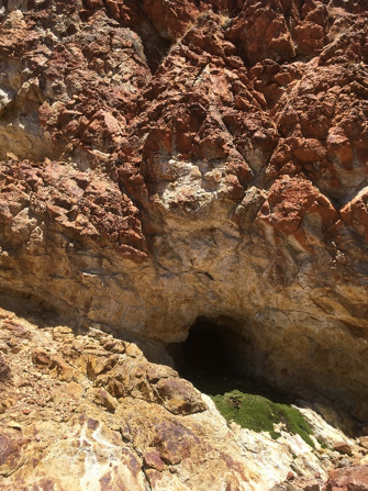
Figure 1: Old Mine Adit at Red Mountain (left) & Figure 2: Snowfall hiding old adit (right)
These adits, along with naturally occurring springs, are where groundwater, stored in the mountains, finds its way to the surface and beings to flow downhill in the small drainages towards Sonoita Creek. These adtis and springs began as coordinates on my GPS and with the help of knowledge and guidance from local Patagonians, materialized into unique sampling locations. Many were down steep gullies or up remote forest service roads. Each time we set out to find a spring or adit, I was sure it would be dry or nonexistent. However, nearly every time I was mistaken. Even in the desert in May, naturally occurring springs produce water, day and night, sustaining wildlife and providing clues to the underground plumbing of the Patagonia mountains. These adits and springs, where water emerges from the subsurface and begins to flow as surface water, combined with a few select wells were the geocaches of the summer’s field work.
Figure 3: Testing Water Quality from Springs (above)
Figure 4: Exploring (right)
Members of a citizen science group named Patagonia Area Water Study helped identify springs and helped navigate the sometimes-steep terrain to find them. The citizen scientists have been collecting water quality data from perennial and ephemeral reaches of creeks within the basin, and the sampled springs may become additional monitoring locations for the citizen science group. The citizen scientists were curious of what we could learn from the samples. How can one determine the “age” of water in a lab? How would our results may help them in their monitoring efforts? I’d explain about isotopes and geochemistry and assure them that we would make the results of our research accessible, understandable and hopefully applicable. The samples were collected, labeled, stored and sent to the lab for analysis.
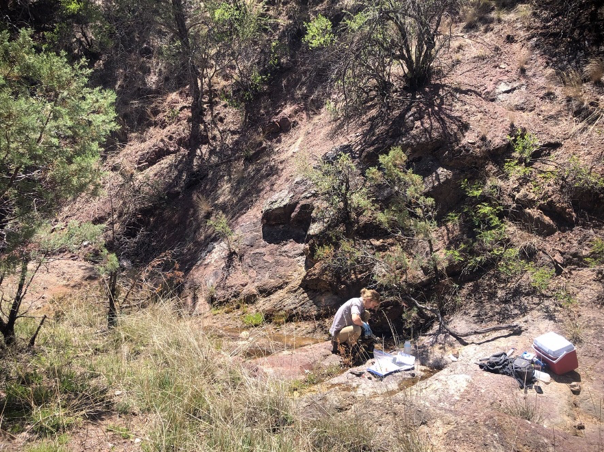
Figure 5: Collecting samples from Spring for Testing
On the Town’s annual Earth Day Celebration, the Town of Patagonia’s Flood and Flow committee set up a meeting to inform citizen on the efforts of the committee and how they could be involved in our research. The meeting was well attended and the concern about the future of water supply within the Sonoita creek basin was evident. Citizens volunteered their wells to be sampled and expressed interest in learning about how pumping in one part of the watershed will affect water availability and quality in distant areas.
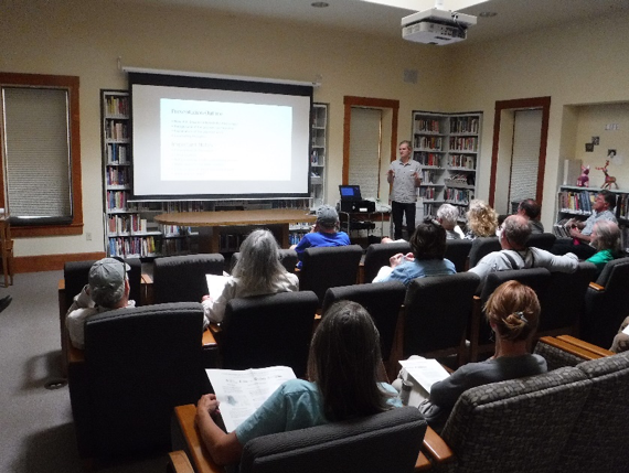
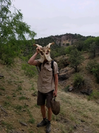
Figure 6: Flood and Flow Committe Meeting (above) & Figure 7: Finding bits of an old Skeleton (left)
 Now, the summer has passed, and monsoons have filled the valleys and creeks with recent rainfall. Further sampling is required but will have to wait until the monsoon rain has washed away. Our hope is that through our analysis we will be able to better understand groundwater movement in the mountains so that decisions around groundwater use can be more informed. We also hope to better understand how variations in climate will impact water availability in the mountains and how vulnerable the springs are to these variations as well as groundwater pumping. Many of the Patagonians who helped identifying springs will be able to monitor these vulnerable springs and note changes overtime.
Loren Eisley says, “if there is magic on this planet, it is contained in water”. Such a feeling is evident in the middle of May, as the desert heat seems to have desiccated every drainage and creek, yet deep in the mountains, with a GPS and a local guide, one can stumble upon springs and ominous adits that leak water from deep within the mountain. Contained in that water is information on the water’s past and the plumbing system of the mountains. The clues that water contains will help to answer some of the mysteries of the mountains and help define the future of the area.