Southwest Climate Outlook March 2019 - Climate Summary
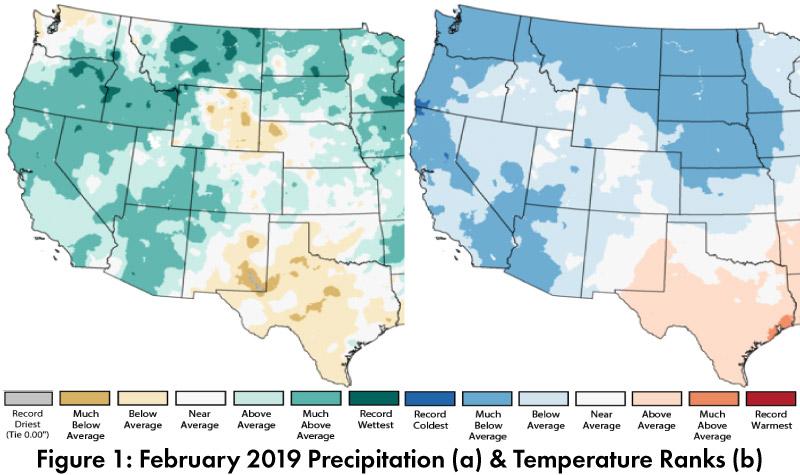
February Precipitation and Temperature: February precipitation was above-average across most of Arizona and northwestern New Mexico (and much of the western United States), but quickly transitioned to below-average in southern and eastern New Mexico, a pattern that extended into western Texas (Fig. 1a). February temperatures were below-average in most of Arizona and northwestern New Mexico, and average to above-average in central and eastern New Mexico (Fig. 1b).

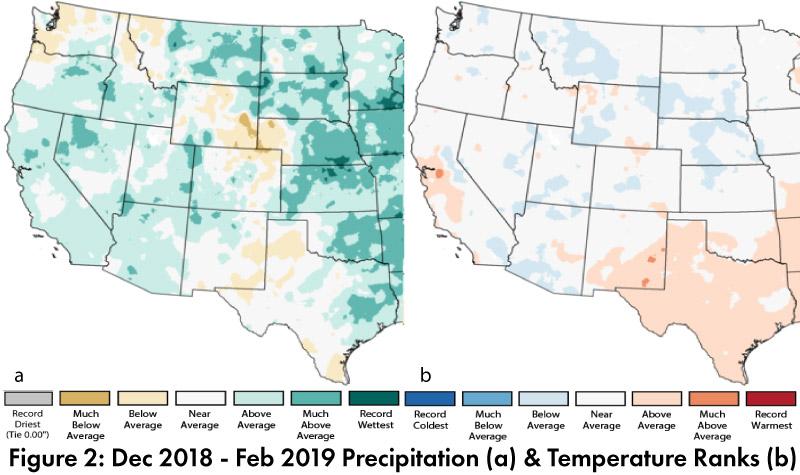
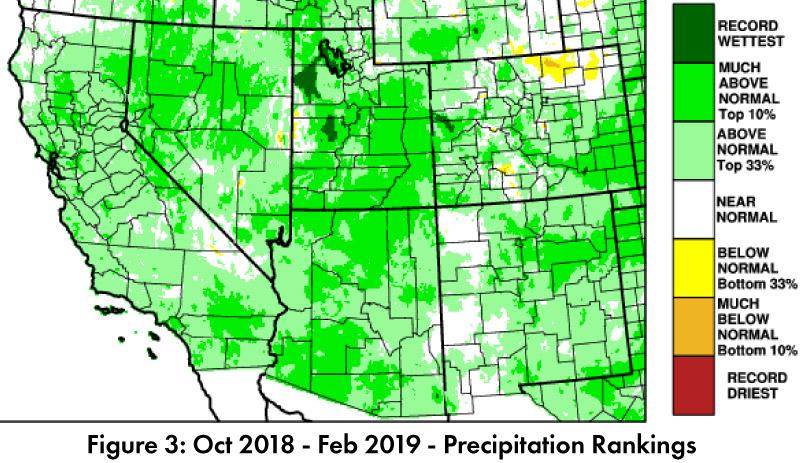
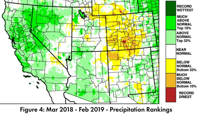
Seasonal Precipitation and Temperature: Dec-Feb precipitation was mostly above-average across Arizona and northwestern New Mexico, while southern and eastern New Mexico ranged from average to below-average (Fig. 2a). Dec-Feb temperature rankings were mostly average to below-average in Arizona, and average to above-average in New Mexico (Fig. 2b). Water year precipitation includes a particularly wet October, and most of the Southwest recorded above-normal precipitation since Oct. 1 (Fig. 3). Twelve month totals highlight above-normal precipitation in much of Arizona and portions of southern and eastern New Mexico, and persistent precipitation deficits in the four corners region (Fig. 4).

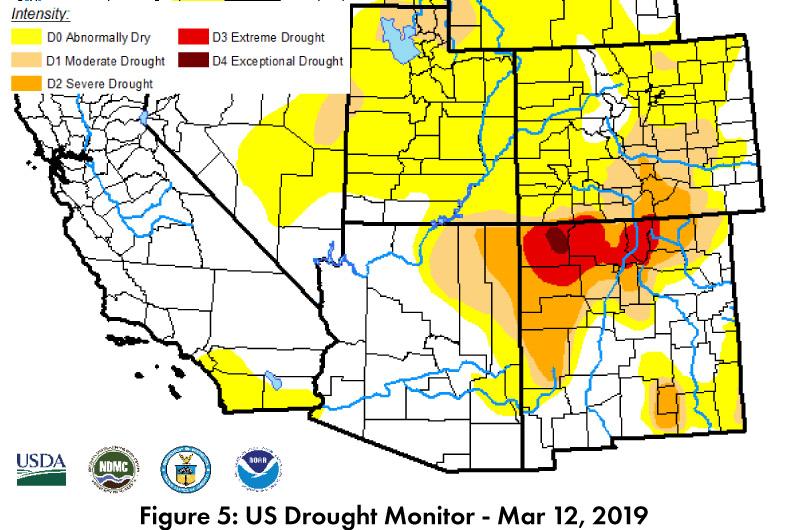
Drought: The Mar. 12 U.S. Drought Monitor (USDM) shows widespread improvements in regional drought conditions in much of the western U.S. (Fig. 5). Persistent drought conditions remain in the Four Corners region, although characterizations of drought extent and intensity are further reduced on this map compared to last month. Accumulated precipitation deficits built up over seasons and years, and in terms of drought recovery, above-normal precipitation in the short term is likely insufficient to make up for years of drought.
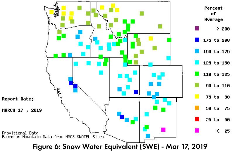
Snowpack & Water Supply: Snow water equivalent (SWE) increased considerably since last month. SWE values (as of Mar. 17) in Arizona and New Mexico are mostly above average, ranging from 110-200 percent of average across most of the region, with only south-central NM at less than 25-percent of average (Fig. 6). Reservoir storage remains a persistent concern with long-term drought and accumulated precipitation deficits. Most of the reservoirs are at or below their long-term averages and a few of the Rio Grande reservoirs are especially low, while central Arizona reservoirs (Verde and Salt River) have recorded large increases over the last month (see Arizona and New Mexico reservoir storage).

El Niño Tracker: Atmospheric conditions finally caught up with the ocean, with both indicating weak El Nino conditions. The current forecasts indicate a strong likelihood of a weak El Niño lasting through spring, and a moderate likelihood it will persist through summer and into fall. This raises the possibility of a second year of El Nino (i.e. continuing next fall into winter 2020), but spring and early summer introduce considerable uncertainty into forecasts, so this is more speculative than certain (see El Niño Tracker for details).
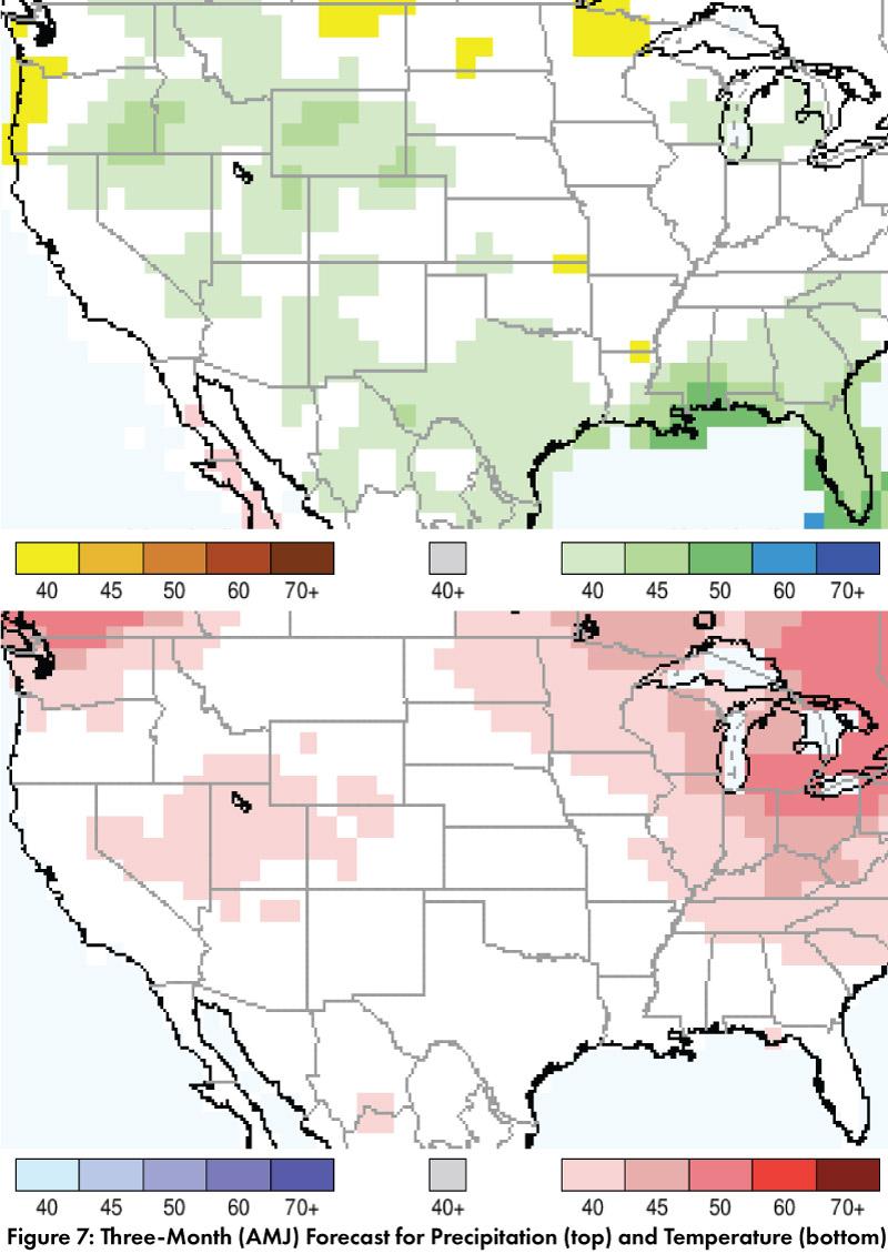
Precipitation and Temperature Forecast: The three-month outlook for April through June calls for increased chances of above-normal precipitation in most of Arizona, New Mexico, Texas, and northern Sonora and Chihuahua, Mexico (Fig. 7, top). The three-month temperature outlook calls for slightly increased chances of above-normal temperatures in pockets of northern Arizona, but otherwise suggests equal chances of above, below, and near normal temperatures (Fig. 7, bottom).
Online Resources
- Figures 1-2, - National Centers for Environmental Information - ncei.noaa.gov
- Figure 3-4,6 - Western Regional Climate Center - wrcc.dri.edu
- Figure 5 - U.S. Drought Monitor - droughtmonitor.unl.edu
- Figure 7 - International Research Institute for Climate and Society - iri.columbia.edu