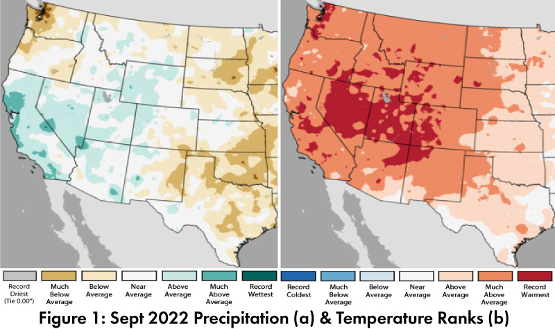
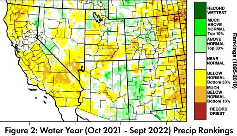
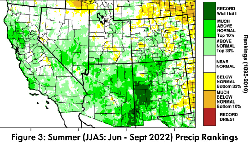
Precipitation and Temperature: Sept precipitation was average to above average in most of Arizona and average to below average in most of New Mexico (Fig. 1a). Sept temperatures were between above average and much above average in most of Arizona and New Mexico, with some pockets of record warmest in the Four Corners region (Fig. 1b). Water year precipitation rebounded with the monsoon in some locations, and water year totals range between below average and above average in most of Arizona and New Mexico (Fig. 2) Summer/Monsoon (JJAS) precipitation rankings for the region demonstrate this rebound, with widespread areas of much above average and large areas of record wettest (Fig. 3).
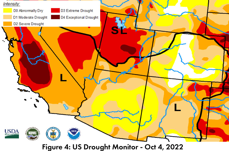
Drought: The Oct 4 U.S. Drought Monitor (USDM) shows another month of decreases in the severity of drought characterizations in parts of Arizona and New Mexico (Fig. 4) following widespread monsoon activity (See Fig. 3). Despite the regional improvement, drought conditions are still found across most of the southwestern United States. Longer-term accumulated precipitation deficits are a factor in these designations. Sustained monsoon activity continues to help reduce extreme drought characterizations but is not enough to fully reverse long-term drought conditions.
Water Supply: Most of the reservoirs in Arizona and New Mexico are at or below the values recorded at this time last year. Most are also below their long-term average (see reservoir storage for Arizona and New Mexico). The shortage declaration for the Colorado River in 2022 and low water levels in the Rio Grande highlight ongoing concerns about the intersection of long-term drought and water resource management, especially with tier 2a restrictions under discussion given current conditions at Lakes Mead and Powell.
ENSO Tracker: The forecast consensus is that La Niña will persist into winter with a return to ENSO-neutral conditions sometime in early 2023 (see ENSO-tracker for details).
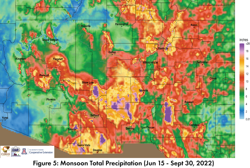
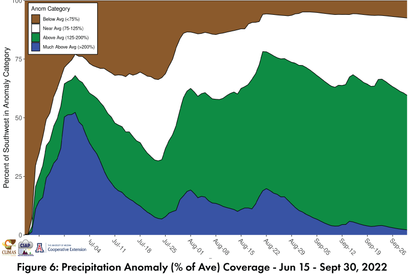
Monsoon: Official monsoon precipitation totals are impressive across the region (Fig. 5). Storms in June helped with an early start, and persistent recent activity has brought nearly the entire region to at or above average, calculated as a percent of the average seasonal total to date (Fig. 6, Fig. 3 also shows the spatial pattern). While the monsoon is officially over, persistent moisture in the Southwest has led to recurrent transition events and storms lasting well into October. This is no longer the monsoon, but does represent a great start to the water year.