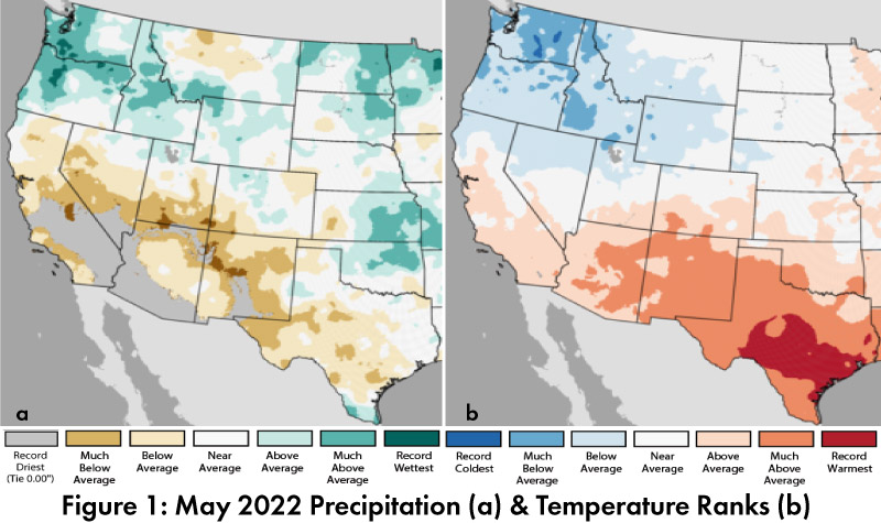
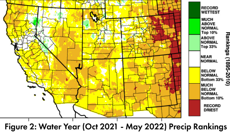
Monthly/Seasonal Precipitation and Temperature: May precipitation was between record dry and below average in most of Arizona and New Mexico (Fig. 1a). May temperatures were above average to much above average in Arizona and New Mexico (Fig. 1b). Water year precipitation is now almost entirely below average or drier in Arizona and New Mexico, with widespread pockets of much below normal, and small pockets of record dry (Fig. 2).
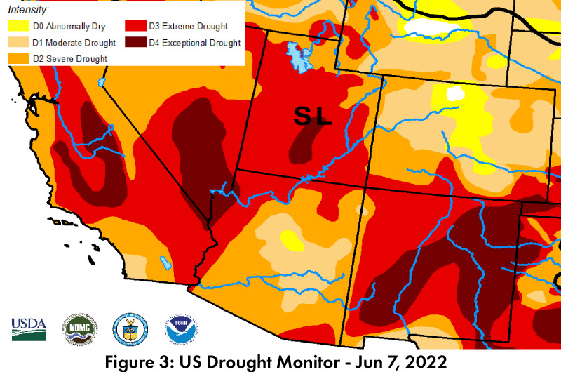
Drought: The Jun 7 U.S. Drought Monitor (USDM) shows increases in categorical severity of drought characterizations in Arizona and particularly in New Mexico (Fig. 3), but drought conditions are found across the entire southwestern United States. Long term accumulated precipitation deficits are a factor in these designations, but the relatively dry conditions over the water year to date are also playing their part in the drought. Rumors of an early start to the monsoon are hopeful but are not likely to reverse long term conditions.
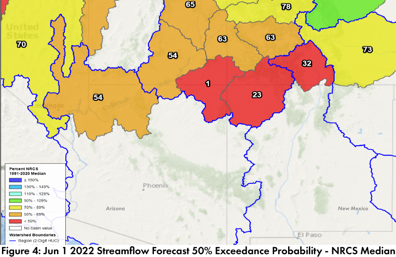
Streamflow & Water Supply: Jun 1 streamflow forecasts are below median in both the Colorado River and Rio Grande basins (Fig. 4). Most of the reservoirs in Arizona and New Mexico are at or below the values recorded at this time last year. Most are also below their long-term average (see reservoir storage for Arizona and New Mexico). The tier one shortage declaration for the Colorado River in 2022 and low water levels in the Rio Grande highlight ongoing concerns about the intersection of long-term drought and water resource management.
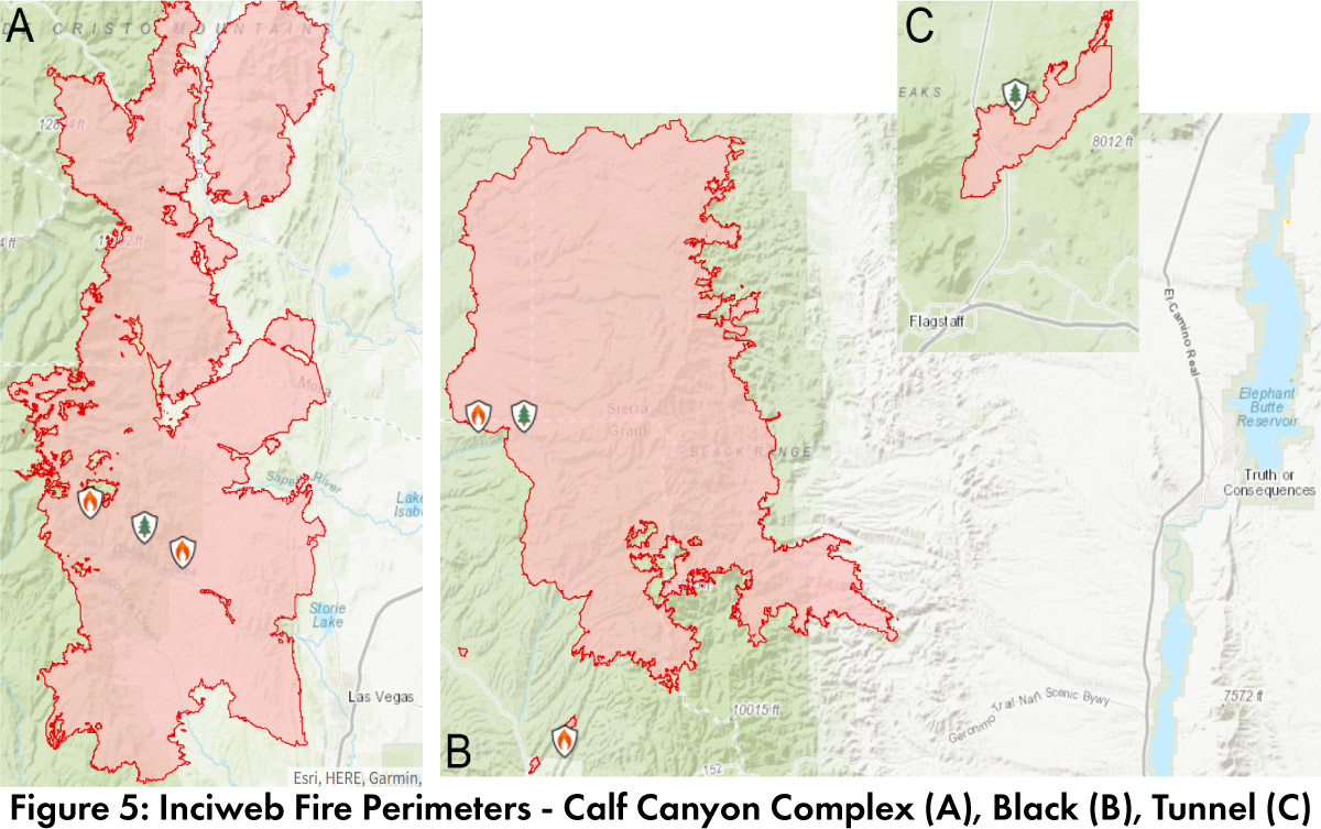
Wildfire: Fire season is well underway in the Southwest, particularly with the Calf Canyon/Hermit Peak Complex fire and the Black Fire in New Mexico (Fig. 5A-B), and the Tunnel Fire (Fig. 5C) and Pipeline Fire in Arizona. Weather has been challenging with high winds and temperatures, combined with very low humidity. The NIFC fire outlooks for July show normal fire risk for Arizona and New Mexico (Fig. 6), with potential for limited relief with the onset of the monsoon but the exact timing is unpredictable and brings increased risk of ignition from lightning.
ENSO Tracker: La Niña persists, and over spring, forecast consensus pivoted from a return to ENSO-neutral conditions over summer, to a slight lean towards La Niña through summer, with some indications of La Niña extending into fall and winter (see ENSO-tracker for details).