Southwest Climate Outlook January 2020 - Climate Summary
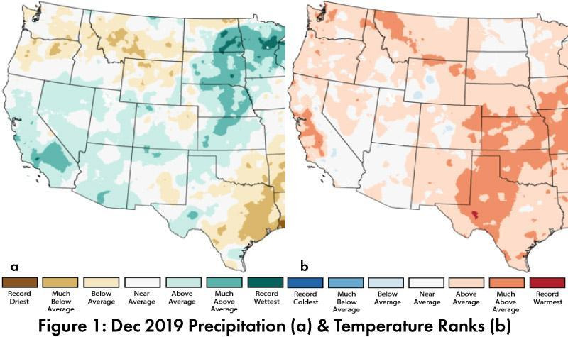
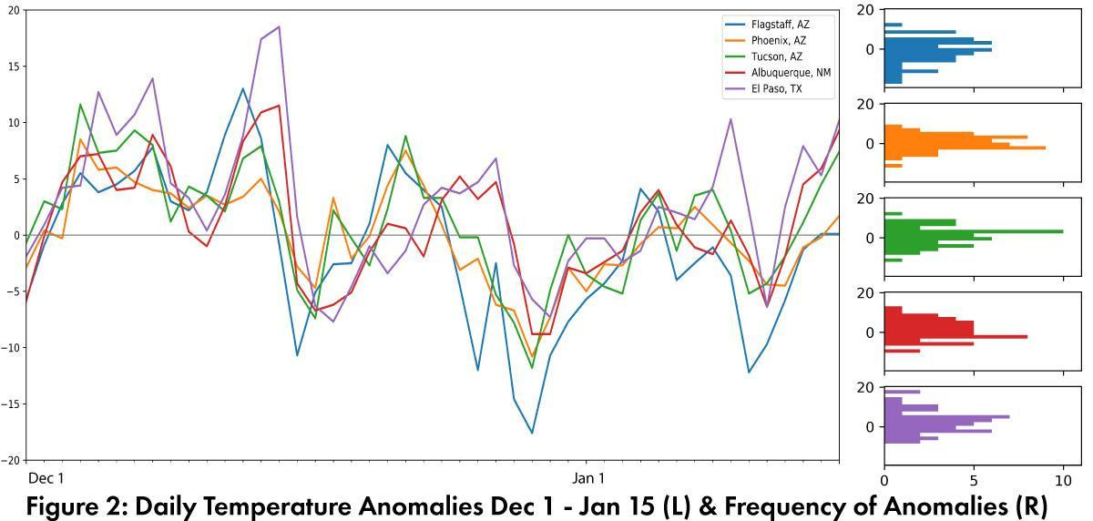
Monthly Precipitation and Temperature: December precipitation was average to above average in most of Arizona, while New Mexico ranged from below average to above average (Fig. 1a). December temperatures were average to above average in Arizona and above average to much above average in New Mexico (Fig. 1b). Daily average temperature anomalies for Dec 1 – Jan 15 (Fig. 2) highlight the fluctuations at select stations around the region. Positive anomalies reflect above average daily temperatures, while negative anomalies reflect below average daily temperatures. The histograms show the frequency of the anomalies for each location.
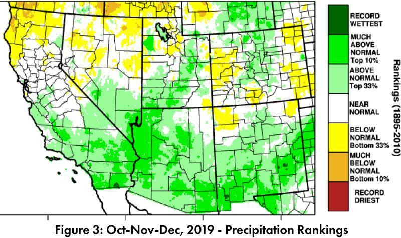
Seasonal Precipitation: Three month precipitation rankings for Oct-Nov-Dec were above normal or much above normal for most of Arizona and New Mexico, with the notable exception of the Four Corners region (Fig. 3), which continues to miss out on recovery from both short and long term drought conditions.
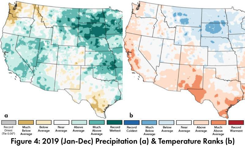
 Annual Precipitation and Temperature: Total precipitation for 2019 in Arizona ranged from below average to much above average, while New Mexico ranged from below average to above average (Fig. 4a). Mean temperatures in 2019 were average to above average in Arizona and average to much above average in New Mexico (Fig. 4b).
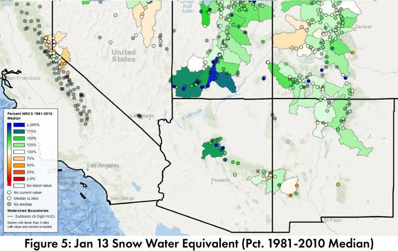
 Snowpack & Water Supply: As of Jan 13, snow water equivalent (SWE) was mostly above median in Arizona, New Mexico, and southern Utah and Colorado (Fig 5). Many of the reservoirs in the region are at or above the values recorded at this time last year, but most are below their long-term average.
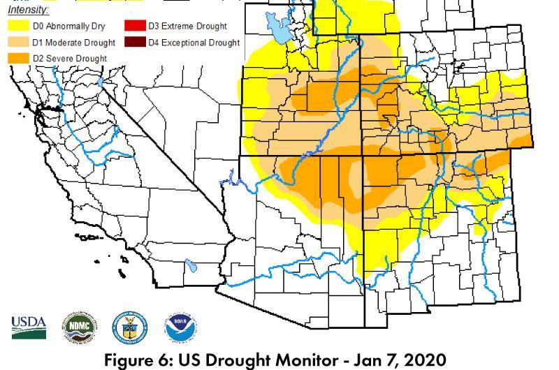
 Drought: The Jan. 6 U.S. Drought Monitor (USDM) has scaled back the intensity and extent of some drought characterizations in the Southwest, but the Four Corners region remains consistently in the center of regional drought designations (Fig. 6). A large pocket of “Moderate Drought” (D1) and “Severe Drought” (D2) is centered on the Four Corners region, reflecting acute and accumulated precipitation deficits.
ENSO Tracker: Oceanic and atmospheric conditions are generally consistent with an ENSO-neutral outlook for 2020.
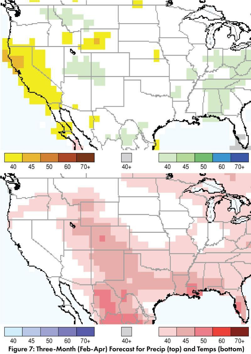
Precipitation Forecast: The three-month outlook for February through April calls for increased chances of below-normal precipitation in California and in small pockets along the U.S.-Mexico borderlands, with equal chances of above or below normal precipitation across much of the rest of the Southwest. Notably, the upper Colorado River Basin is forecast for increased chances of above normal precipitation (Fig. 7, top). Temperature Forecast: The three-month temperature outlook calls for increased chances of above-normal temperatures across Texas, New Mexico, and most of Arizona, along with much of north central Mexico (Fig. 7, bottom).
 Online Resources
- Figures 1, 4 - National Centers for Environmental Information - ncei.noaa.gov
- Figure 2 - Climate Assessment for the Southwest - climas.arizona.edu
- Figure 3 - West Wide Drought Tracker - wrcc.dri.edu/wwdt
- Figure 5 - Natural Resources Conservation Service - nrcs.usda.gov
- Figure 6 - U.S. Drought Monitor - droughtmonitor.unl.edu
- Figure 7 - International Research Institute for Climate and Society - iri.columbia.edu