Southwest Climate Outlook - El Niño Tracker - March 2020
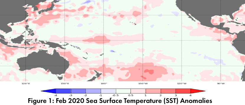
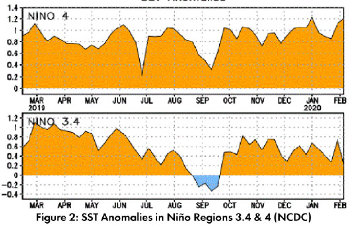
Positive sea surface temperature (SST) anomalies remain in the equatorial Pacific, particularly in the western regions (Figs. 1-2). Despite lingering warm waters, forecasts expect overall conditions will stay in the range of ENSO-neutral through at least summer 2020.
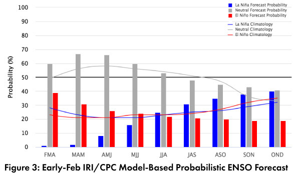
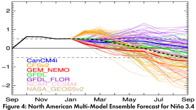
Forecast Roundup: On Mar 3, the Australian Bureau of Meteorology maintained their ENSO outlook at an inactive status, seeing “little or no sign of El Niño or La Niña developing in the coming months.” On Mar 12, the NOAA Climate Prediction Center (CPC) issued its ENSO diagnostic discussion with an inactive alert status. The CPC called for a 65-percent chance of ENSO-neutral through spring 2020 and a 55-percent chance of ENSO-neutral lasting through summer. They highlighted that while SSTs were near the El Nino threshold in the short term, forecaster consensus was for a gradual decline of these positive anomalies, and with oceanic and atmospheric conditions to remain consistent overall with ENSO-neutral through at least mid-2020. On Mar 12, the International Research Institute (IRI) issued an ENSO Quick Look (Fig. 3), noting a “split between neutral and weak El Nino conditions” in the short-term, but that they expect conditions to remain ENSO-neutral overall. On Mar 10, the Japanese Meteorological Agency (JMA) maintained its call for a 60-percent chance of ENSO-neutral conditions to last until summer 2020. The Feb 2020 North American Multi-Model Ensemble (NMME) continues steady movement into ENSO-neutral territory and is forecast to remain there at least through early summer (Fig. 4).
Summary: Much like last month, positive SST anomalies persist, and some of the forecasts even reference El Nino conditions. Also similar to the previous month, none of the forecasts see much chance of an El Nino event…why? The positive SSTs reflect warmer than average oceanic conditions and are occasionally in the range of weak El Nino thresholds. To be considered an El Nino event, the three-month average would need to stay above this threshold for five consecutive months. The atmosphere would also need to cooperate (often called ‘oceanic-atmospheric coupling’). Current forecasts do not expect these positive SST anomalies to last long enough to meet the El Nino criteria, much less see sufficient evidence in atmospheric conditions. ENSO-neutral remains by far the most likely outcome. As we noted last month, in the Southwest, ENSO-neutral winters have produced some of the wettest and driest winters (and everything in between). We continue to monitor sub-seasonal and short term forecasts for insight into upcoming events.
Online Resources
- Figures 1 - Australian Bureau of Meteorology - bom.gov.au/climate/enso
- Figure 2 - NOAA - Climate Prediction Center - cpc.ncep.noaa.gov
- Figure 3 - International Research Institute for Climate and Society - iri.columbia.edu
- Figure 4 - NOAA - Climate Prediction Center - cpc.ncep.noaa.gov